
A Circle on a Map Can Unmask You. Meanwhile Apple Remade the Map Itself.
The Supreme Court is deciding what one warrant really unlocks -- and Apple quietly shipped 3d gaussian splatting to 350 cities. Plus, is the strait of hormuz open or closed?

Welcome to the frontier!
Two stories about maps this week. They seem unrelated. They’re not.
In one, the Supreme Court is deciding whether the cops can draw a circle on a map and demand everyone standing inside it. In the other, Apple quietly remade the map itself -- shipping photorealistic 3D to ~350 cities using a technique it wouldn’t even say out loud on stage.
The former is about activity in the world -- the dynamic layer, the movement and behavior we throw off every day. The latter is about the 3D substrate all that activity gets layered onto.
Two halves of the same machine -- physical reality is becoming machine-readable at an insane pace, and the rules are nowhere close to caught up.
Let’s get into both. Plus (because y’all have been asking!) a quick note at the end on whether the Strait of Hormuz is actually open right now.
The circle on the map
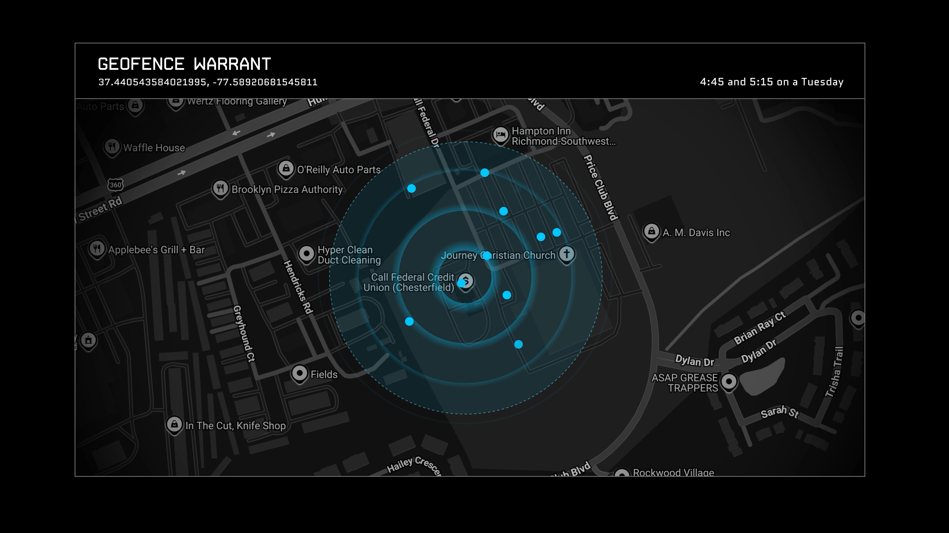
How a geofence warrant can scoop up everyone in the circle — not just the suspect
Why Google increasingly answers "we don't have that anymore"
The cloud, the carrier, the car — who else knows your location
The mosaic theory: how one circle becomes a portrait of your life
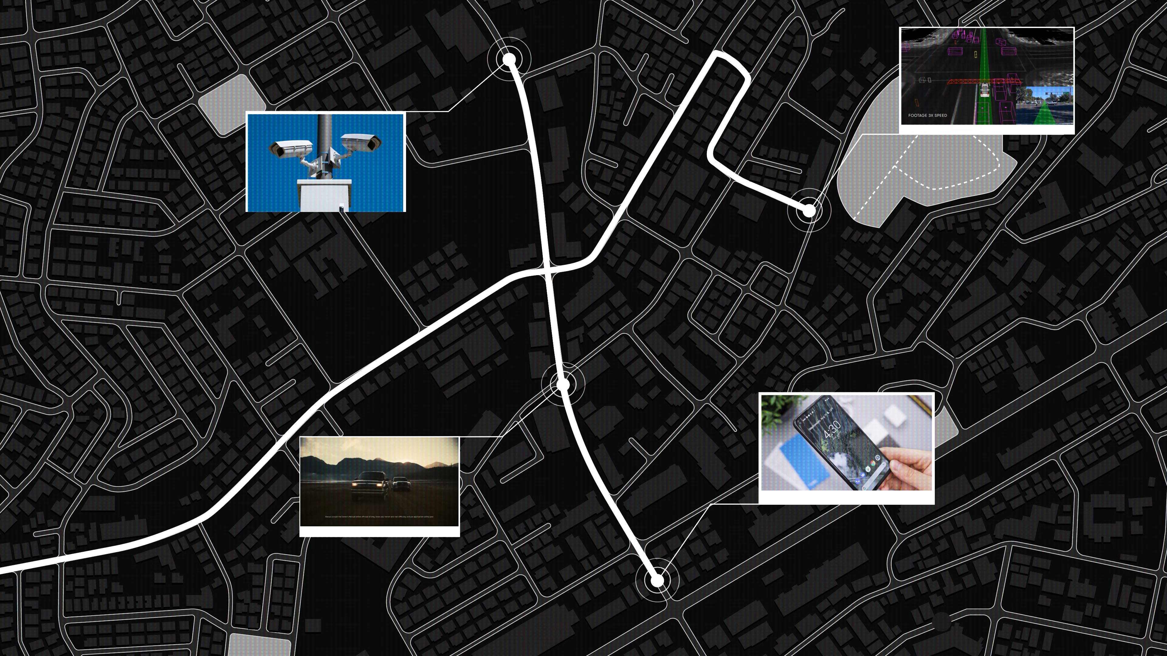
There is an uproar across the country over Flock cameras -- license plate readers bolted to traffic poles, scanning every car that passes. Fair concern. But while everyone’s yelling about cameras on poles, the phone in your pocket has been logging far more than any of them ever could. Not snapshots -- patterns. A continuous record of your life.
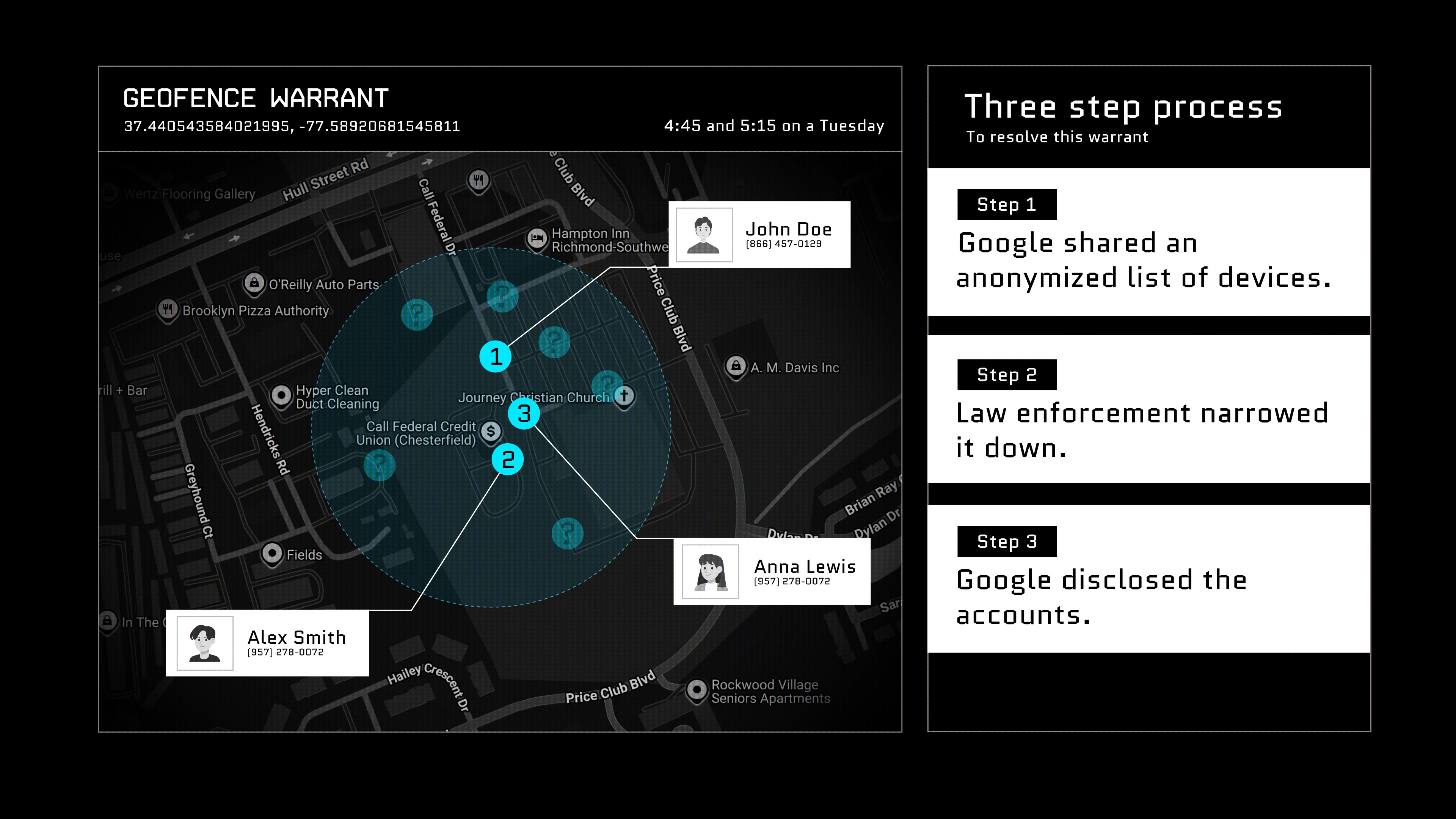
The tool that pulls it is a geofence warrant. The police draw a circle on a map, pick a time window, and ask for everyone inside it. Not the suspect. Everyone. That anonymized list is winnowed down by law enforcement, after which the identities are finally unmasked.
Google’s old location database used to be the goldmine -- a record of basically everywhere every Android user had ever been. To their credit, they built in restraint, making it a multi-step process to unmask identities.
Then in late 2023 Google went a step further by moving your location timeline onto your device, auto-deleting every three months, encrypted with a key only your phone holds. So now when a warrant lands, Google increasingly answers: we don’t have that anymore. That historical trail was never the moat. It was a liability.
Apple never built that database at all, so it doesn’t even respond to geofence warrants. But don’t let that make you feel safe. Your phone still pings cell towers every few seconds -- subpoena the carrier. Uber and Lyft have you. Modern cars log telematics straight back to the manufacturer. Waymo uploads everything to the cloud. And Tesla keeps its camera footage local, on a USB drive in the glovebox -- so in 2024 Oakland police just towed innocent bystanders’ Teslas to get at it. Lock down one channel and they just move to the next -- right down to towing the whole damn car.
The big idea worth carrying out of all this. Legal scholars call it the mosaic theory: one tile is meaningless, but a thousand tiles fused together is a portrait. A cop writing down plates on a corner is a tile. An AI fusing every camera, every ping, every Waymo clip across a city for 60 days is a portrait of a life.
In fairness, the case for these warrants is real: there’s an actual crime, a judge signs off, the radius and time window are narrow. Don’t ban the tool, police the tool. But that misses the mosaic -- because one circle unmasks one person, and then the follow-on pulls begin, none of them ever seen by the judge who signed the original.
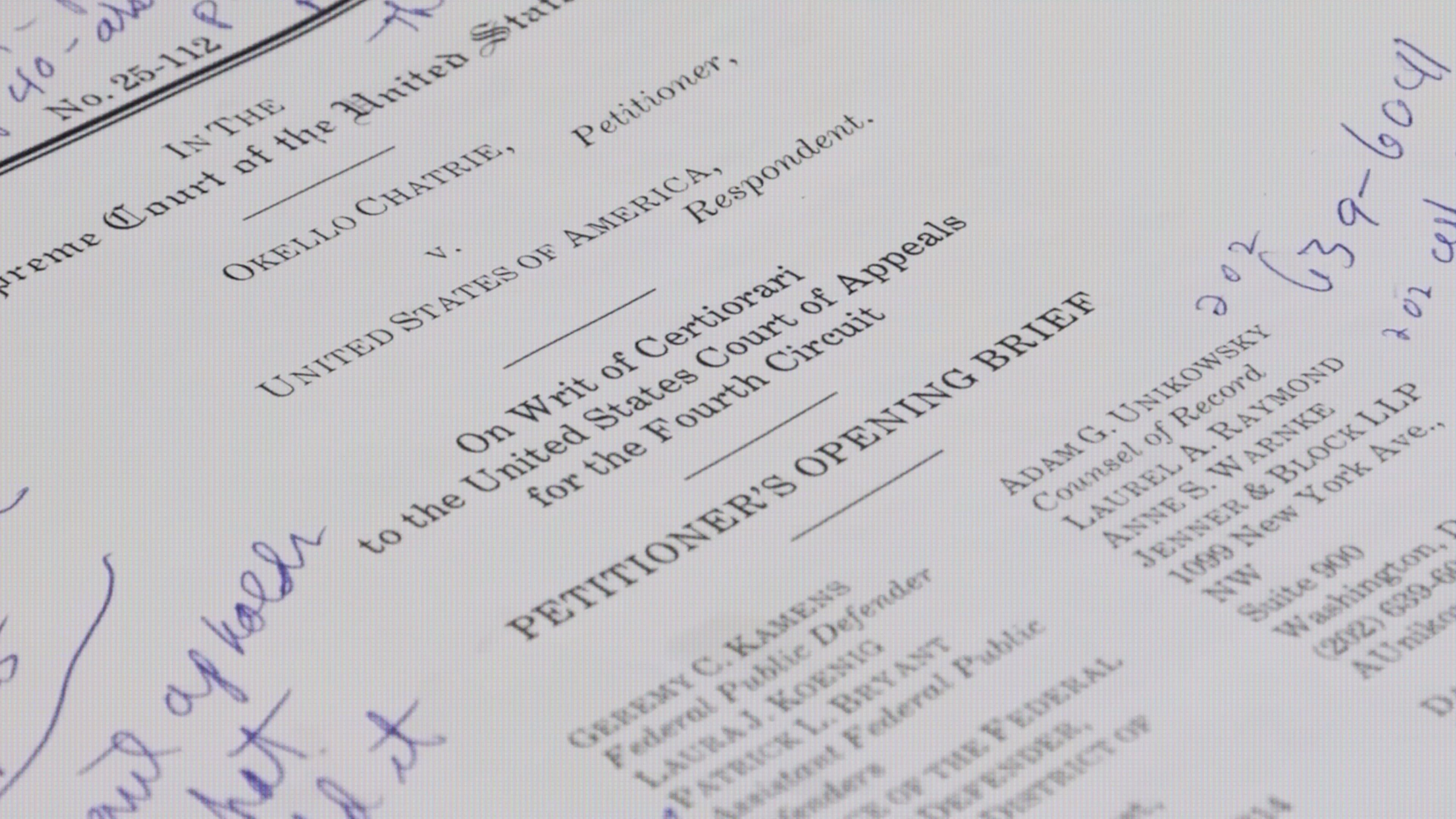
That’s what the Supreme Court is actually contending with this summer. And the part that should keep you up: the same architecture that draws a circle around a place could just as easily draw one around a search query. I walk through the whole stack -- and the case that’ll decide it -- in the video.
▶️ Watch the full breakdown on YouTube
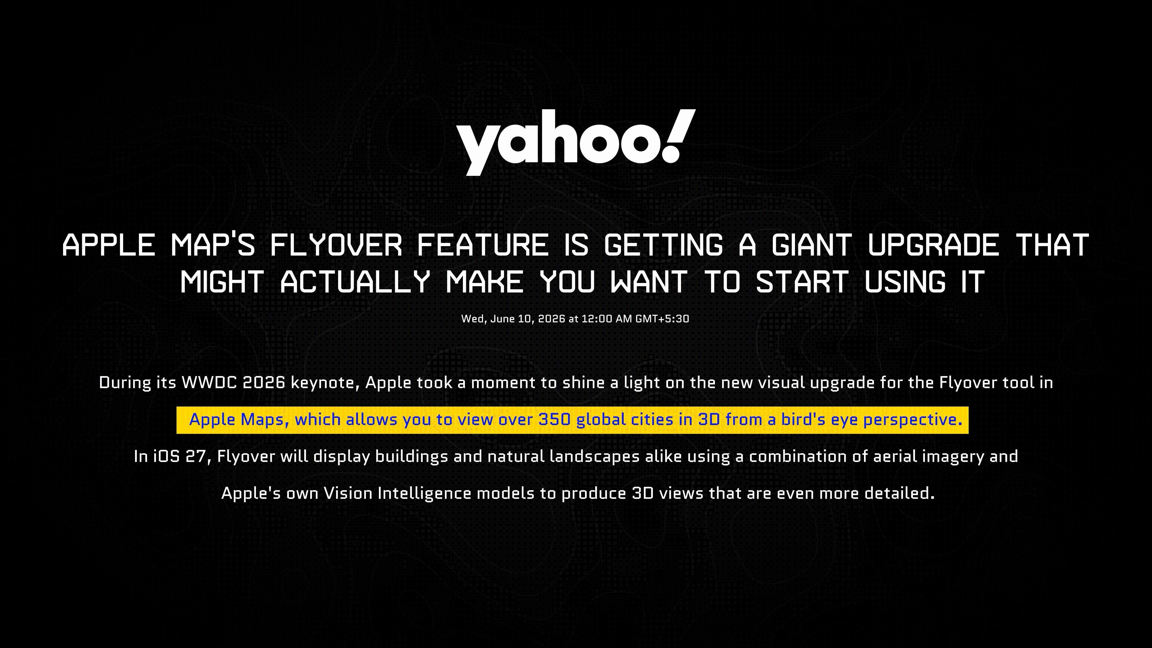
Apple just remade the map itself
Why the new Maps make the old version look like a 2003 video game
The technique Apple refused to name on stage
The hybrid mesh-plus-splat hack that scales it to 350+ cities
Where it still breaks — and the street-level fusion that comes next
Now the other direction -- the 3D substrate upon which all this data can be layered.
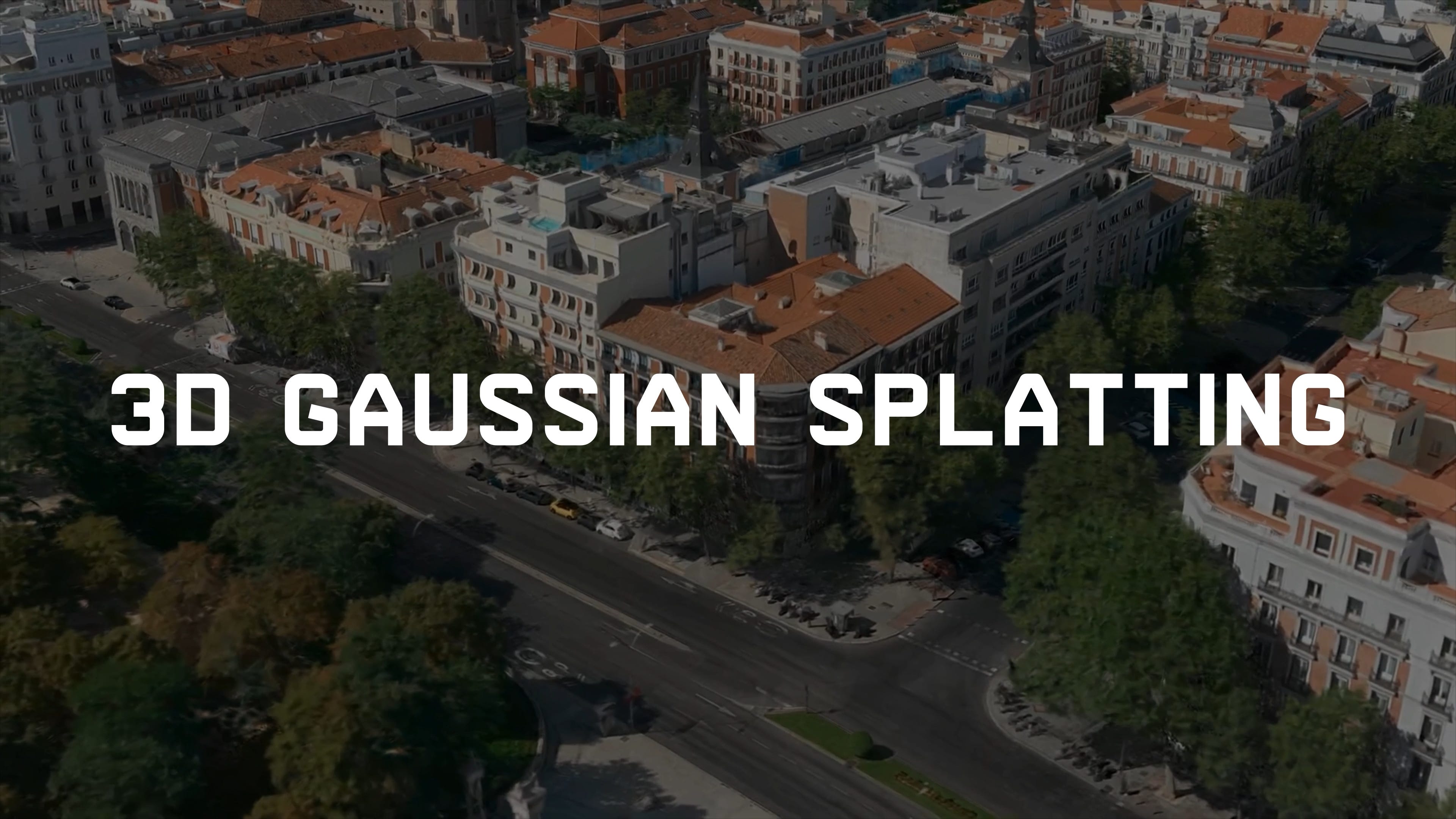
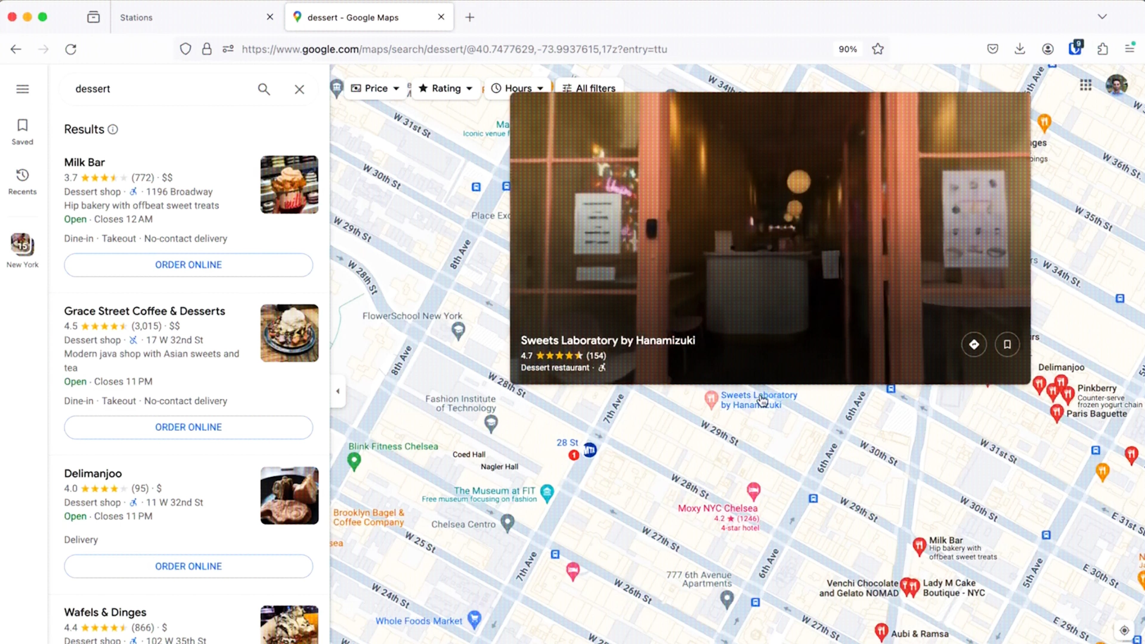
Apple Maps just got a visual upgrade so good it makes the old version look like a video game from 2003. The tech behind it is 3D Gaussian splatting, and in classic Apple fashion they wouldn’t say the words on stage. They just described the result: sharper trees, light bouncing off glass, ground-level detail that holds up.
At WWDC they announced 350+ cities getting this treatment in Flyover, landing this fall in iOS 27, macOS 27, and visionOS 27. They didn’t name the technique, but the community clocked it instantly -- and Apple’s been leaving a paper trail anyway: years of splatting hires, a model called Sharp open-sourced in December 2025, the same representation already powering Persona avatars.
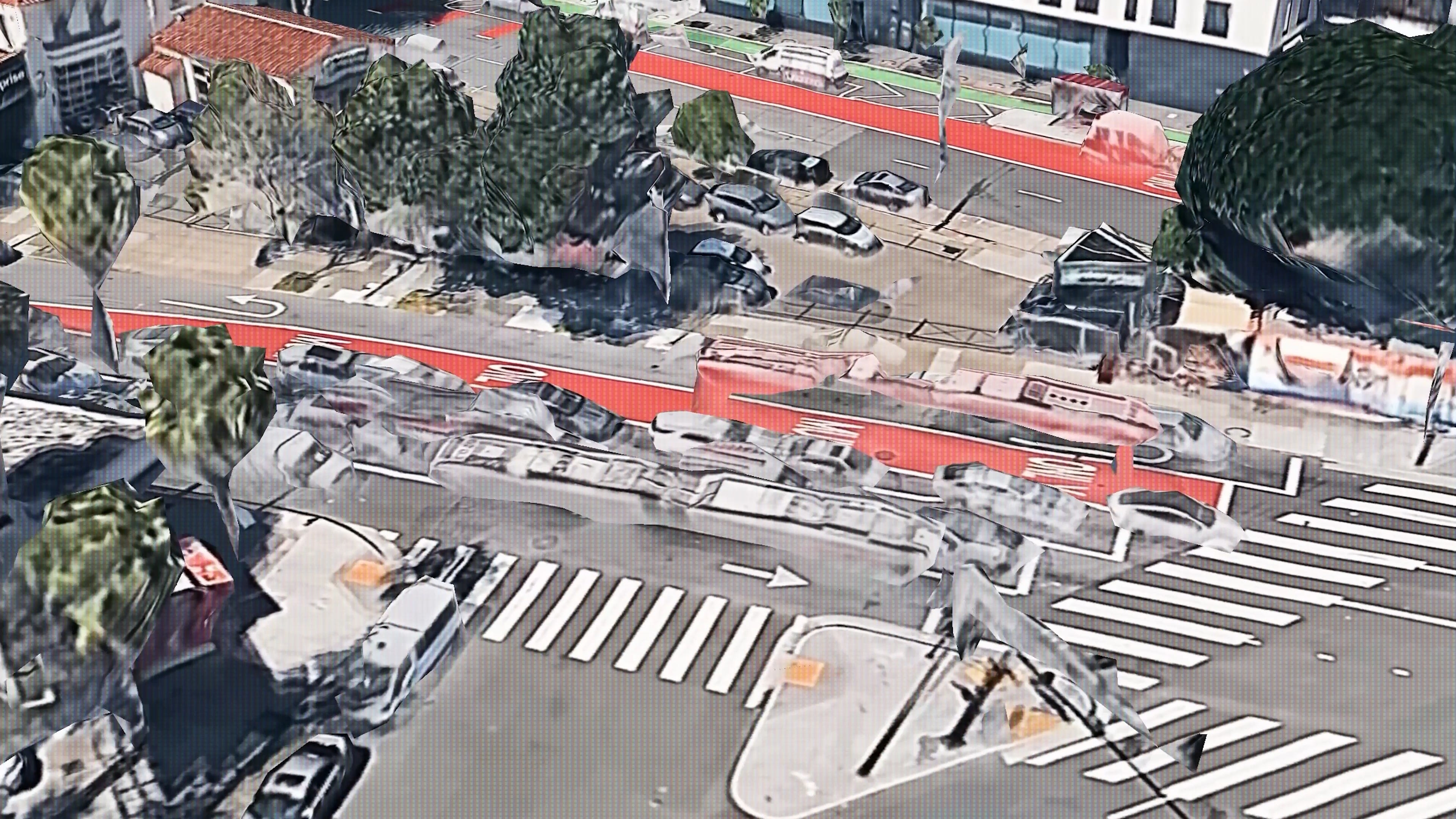
Here’s why it matters. The old way is photogrammetry -- textured 3D meshes built from aerial photos. It’s been the standard for 30 years and it has three signature failure modes: thin geometry like power lines just vanishes, glass turns into cardboard cutouts, and trees become what we in the industry call broccoli trees -- lumpy green blobs. Splatting fixes all three because you’re encoding light, not shape.
But the detail most of the coverage is missing: Apple’s implementation is a hybrid. Flat stuff -- roads, plain facades -- stays cheap textured mesh. Only the complex geometry, the trees and poles and fine detail, gets the splat treatment. That optimization is exactly what lets them scale this to hundreds of cities instead of a demo block.
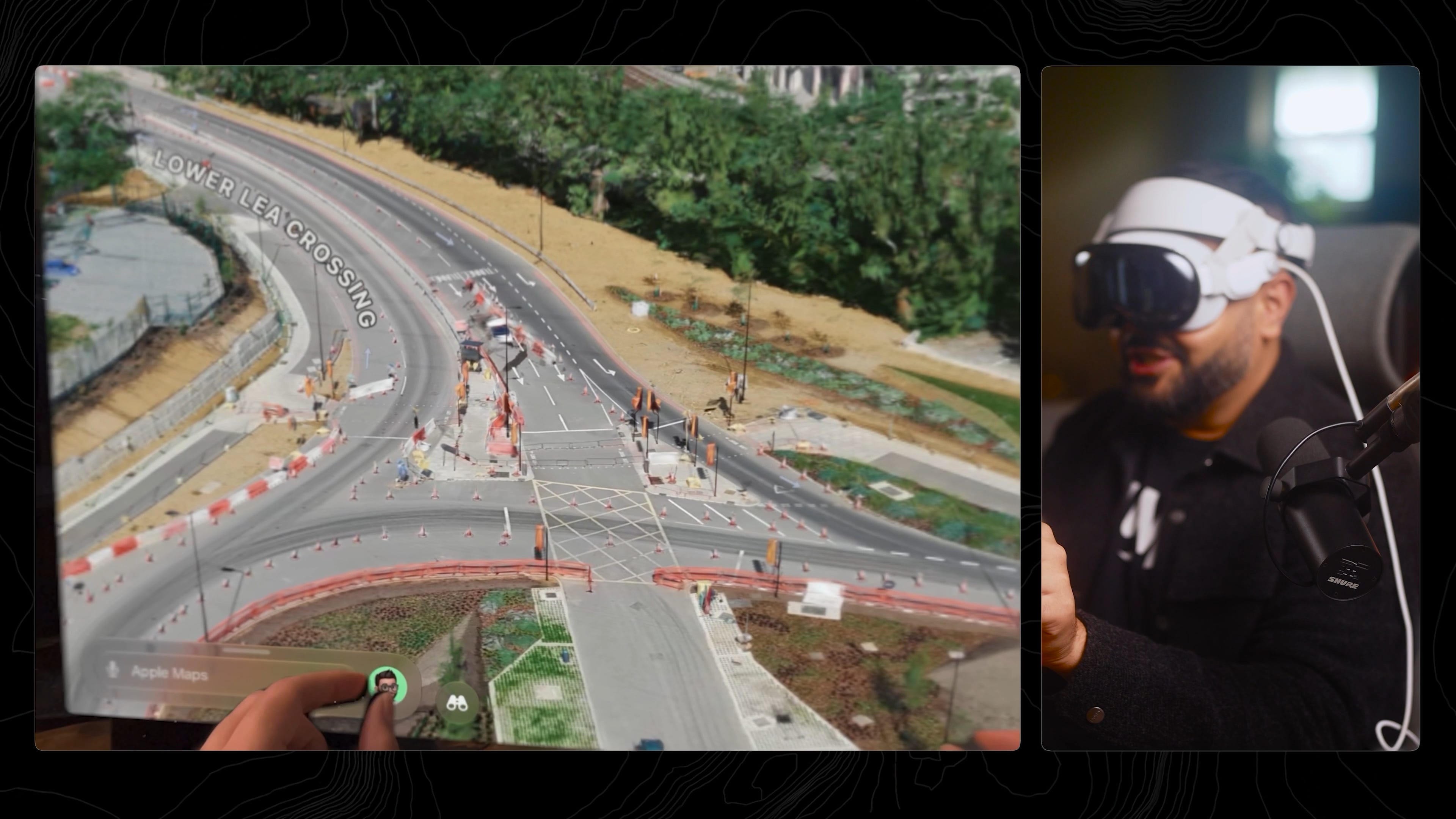
And in the hands-on it shows. London is immaculate -- low-altitude flights are allowed there, so you can get down to the construction cones on the ground. Monaco’s coastline is gorgeous (though the Prince’s Palace is conveniently withheld, the way high-detail reconstructions often are for security). Vegas’s High Roller, on the other hand, is a mess -- it was rotating during capture, so the wheel reconstructed into spaghetti. Someone’s going to have to model that one by hand.
Credit where it's due: Apple nailed this. The part worth dwelling on is the direction. Apple went top-down -- aerial capture, shipped as a polished consumer feature at city scale. Google's been coming at it from the bottom up: radiance fields indoors and upward, those interior 3D scans already in Maps. Two ends of the same arc converging on one continuous model of the world.
But don’t read this as “prettier maps.” It’s a new way to encode physical reality into machines. The real prize is fusing street-level and aerial captures into one continuous model of the world -- something we were already teasing in a TechCrunch piece back in 2021, now suddenly buildable. We went from a SIGGRAPH paper to a shipping Apple Maps feature in about two years. That velocity is the actual story.
Apple just fired the starting gun. Google has the data and the talent and will respond. And I’d bet the real payoff lands next year: a native Vision Pro app where you drop in as your Persona and walk a whole city in 3D.
▶️ Watch the full walkthrough + live demos on YouTube →
One quick hit: is Hormuz actually open?
Came up over lunch so I voice noted my agent to “boot up god’s eye view and check.”
It sent me back this timelapse clip -- refreshed the AIS data, checked oil futures, mapped 120 days of vessel transits and rendered it out.
TL;DR it’s kinda open. Traffic is moving again, just not back to pre-conflict normal. Feels like I have a geopolitical analyst on demand. Worth a glance if you’ve been following the US-Israel/Iran saga.

That’s the dispatch. See you in the next one!
-- Bilawal Sidhu
Amazing and scary, at the same time.